Back to Introduction
Forward to
Day 2: Sterling - Julesburg
August 17, 2002. Day 1. Fort Collins to
Sterling (map).
Distance traveled: 110 miles
Time moving:
9 hours, 29 minutes
Time stopped:
2 hours, 14 minutes
Ending elevation: 3956 ft
Max speed:
30.9 mph
Moving average speed: 11.5 mph
Overall average speed: 9.3 mph
Cumulative climbing: 3286 ft
Cumulative descent: 4475 ft
Cumulative distance: 110 miles
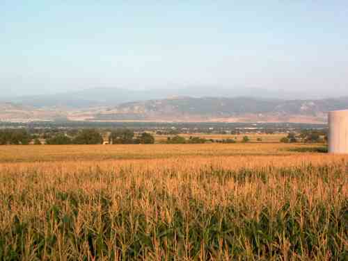
Goodbye Fort Collins. Looking west from the intersection of Colorado
Highways 14 and 257. This is also the highest elevation of
the ride at about 5180 feet.
I woke up at about 4:30, and was excited to get this
adventure underway after thinking, planning, training, and
buying in preparation for over a year. I went over the bike
one last time, making sure that the tires were pumped, no screws were
loose, and the wheels were true. All things I had done over and
over again last night. But it was still dark, and I did not want
to leave too much before daybreak.
After breakfast of pancakes, fruit, and coffee, some
light was appearing in the east and it was time to get moving.
I left home at around 6:00 am, and it was very cool, in the
low 50s, and perhaps even upper 40s in some low spots. After about
9 miles I was at I-25 and CO 14, and was a bit chilled despite pushing
all this extra weight around, so I stopped at McDonald's for a cup
of coffee and a biscuit. The bike handled well, but the front lowrider
panniers added some wobbles that took some getting used to.
The first 46 miles of the ride are very familiar, I
have ridden highway 14 to Ault many times, and have ridden to or
from Briggsdale four times. It is a hilly ride, but the road has
reasonably wide shoulders and I enjoy the changing of the scenery from
the urban area around Fort Collins to the irrigated farmland around Ault,
to the dryland fields and grazing lands further east.
I reached Briggsdale at about 10:00 (46.5 miles from
home), and rested at the Crow Valley campground, which is part of
Pawnee National Grassland
and has shade, water, and picnic tables.
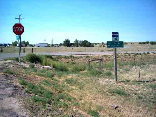
CO 14 and Weld County Road 77, Briggsdale.
I was making good time, the weather was cool, and
everything was going according to plan. I spent about a half an
hour at the campground resting, birdwatching, and refilling water
bottles. Soon I was back on the road and heading east.
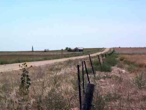
View to the south at CO 14 and WCR 119.
There is something about the open nature of the Great Plains
that is appealing, in a very subtle way. Today, a warm, dry day in
midafternoon, this spot is very quiet, and being a drought year, it
feels barren and stark. But on a cool, early summer morning, the
sounds of thousands of songbirds can produce a bewildering, euphoric
state of mind. Anyone interested in the history, ecology,
and future of the high plains should read Richard Manning's book Grassland,
which may very well change the way you see the "empty wasteland" that is much
of the American west. Another excellent book is Great Plains
by Ian Frazier
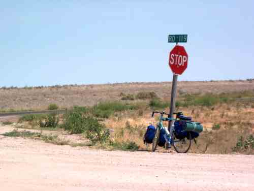
My bike at CO 14 and WCR 119
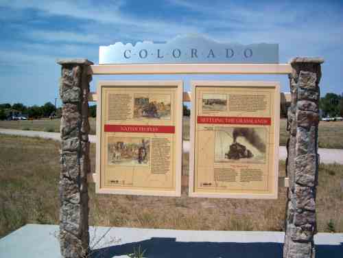
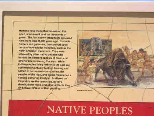
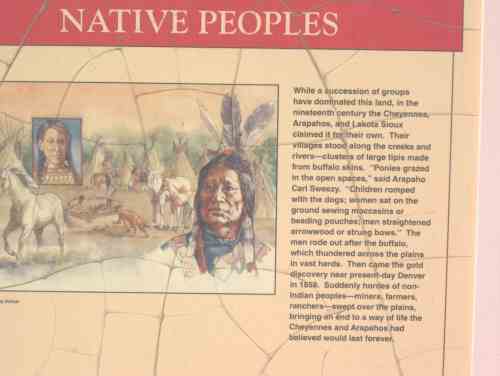
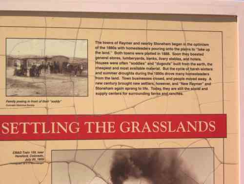
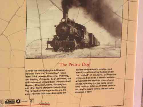
New Raymer historical marker
At about 11:00, the wind picked up, out of the ESE. In
other words mostly a headwind. This wind grew steadily stronger,
but it was still cool, and I was looking forward to stopping for lunch
at the Pawnee Station cafe in New Raymer. CLOSED! Bummer.
I had plenty of "energy food" along, but I was ready for a sit-down
rest and could use a good meal for a break. I did stop for a rest
at the rodeo grounds across the street, and photographed the marker that
talks about some of the local history. The area was served by rail
until 1980. I managed to embarrass myself by falling over on the gravel
road when I was getting back on my bike. Still getting used to the
added weight and change in balance of the bike.
From New Raymer it is 8 miles to Stoneham, and I knew
there is also a cafe there but didn't have any idea whether it would
be open or closed.
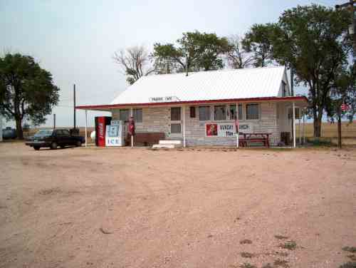
Prairie Cafe, Stoneham Colorado.
This is a genuine 3-calendar cafe.
I had one of the best burgers ever, fried in an electric frying
pan probably purchased at Target or Walmart. It was interesting
to listen to the folks in there talk about how someone they know moved
out of Greeley because it has gotten too expensive.
The woman running the cafe was used to seeing cross-country cyclists,
she said they pass by "all the time" which I interpret to mean one
a week or so. This is one of the few routes that make a good passage
through the central plains.
I had been on the road for about 8 hours and ridden 83 miles. The
first 46 miles had taken 4 hours, the next 37 miles took nearly that
long -- the headwinds were taking their toll, and I still had 25 miles
to go to reach Sterling. I could camp if necessary (camping is
allowed in most of the Pawnee Grasslands) but the biggest problem would
be food and water -- I didn't have enough of the right kind of food
to be camping, and there are no commercial establishments between here
and Sterling.
So, I headed on, and the wind had really picked up, even the downhill stretches
were slow and required work. The couple that owns the Prairie Cafe
also makes painted wooden "whirligigs" based on their own designs and
various cartoon characters and other fanciful things. The legs on
the Coyote were spinning at quite a clip when I left. They also make
clocks, dollhouses, and other simple but well done decorations.
Back on the road, persistence paid off, and I checked in to a motel in
Sterling at about 5:30. Watched Booknotes on
CSPAN, and saw an interesting interview with Simon Worrall discussing
his book "The Poet and
the Murderer". It is the story of Mark Hoffman, a forger who
was best known for falsifying documents describing the early history
of the Mormon Church (and committing murder to cover his tracks) but he
also forged other historical documents, including a manuscript by Emily
Dickinson. This was a fascinating interview, and I will have to
read this book.
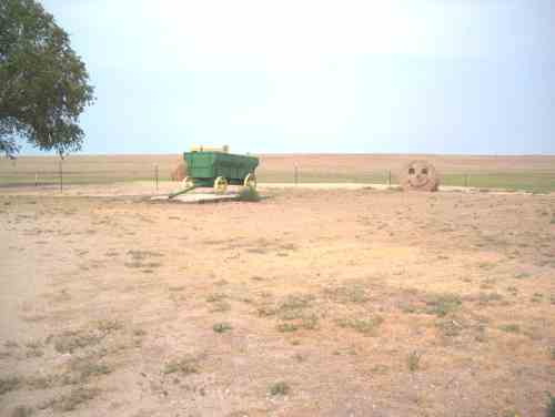
Near Stoneham.
Back to Introduction
Forward to
Day 2: Sterling - Julesburg